Click map to enlarge
The City and County of Denver’s Department of Transportation & Infrastructure is ready to advance the Buchtel Complete Street and Evans Intersection Improvements project forward into the final design phase.
This is a self-guided online meeting for you to learn about the final design refinements.
We’re developing transportation safety and mobility projects to improve streets and the quality of life for residents, visitors, and businesses to ensure everyone is safe no matter how you get around.
If you participated in the spring 2022 virtual public meeting, welcome back! If you’re new, welcome aboard! We’re excited to share the progress we’ve made and to check in with you to ensure we’re on the right track.
As you navigate through the online meeting, you're invited to provide input on the final design refinements for the project area.
The following information will help us make sure we are reaching people most impacted by the project.

Denver has heard from community members during past studies, including Denver Moves and the 2017 University/Colorado Multi-Station Plan and Mobility Study, that you want better connections to the University Station and Colorado Station Areas, and that we should prioritize improving safety.
The Buchtel & Colorado Boulevard Intersection Improvements were approved by Denver voters as part of the Elevate Denver Bond. This safety and mobility project will follow the recommendations from these earlier studies to improve streets and the quality of life for residents, visitors, and businesses to ensure everyone is safe no matter how you get around.
The purpose of the Multi-Station Plan & Mobility Study was to identify a cohesive strategy and key implementable actions to increase local connectivity, access and mobility to the University and Colorado light rail stations, resulting in more vibrant people-friendly stations integral to the surrounding communities.

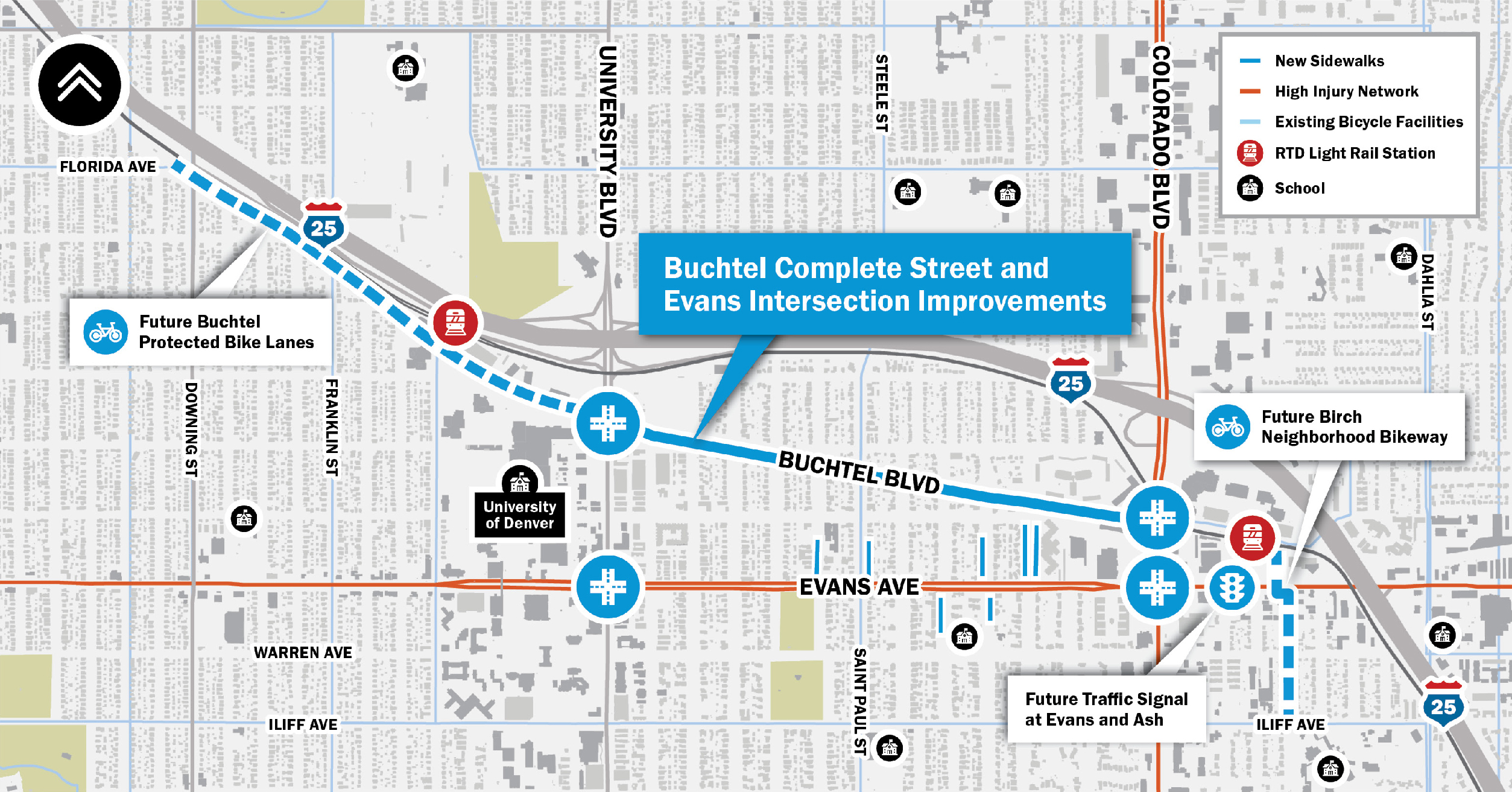
The following map highlights the suite of projects included in the University Neighborhoods Safer Streets Program. The Buchtel Complete Street and Evans Intersection project is part of a larger transportation planning and design effort under the University Neighborhoods Safer Streets Program.
Click map to enlarge
Building upon previous planning efforts and initial design concepts, the following project improvements are included in the final design refinements as part of the Elevate Bond project.
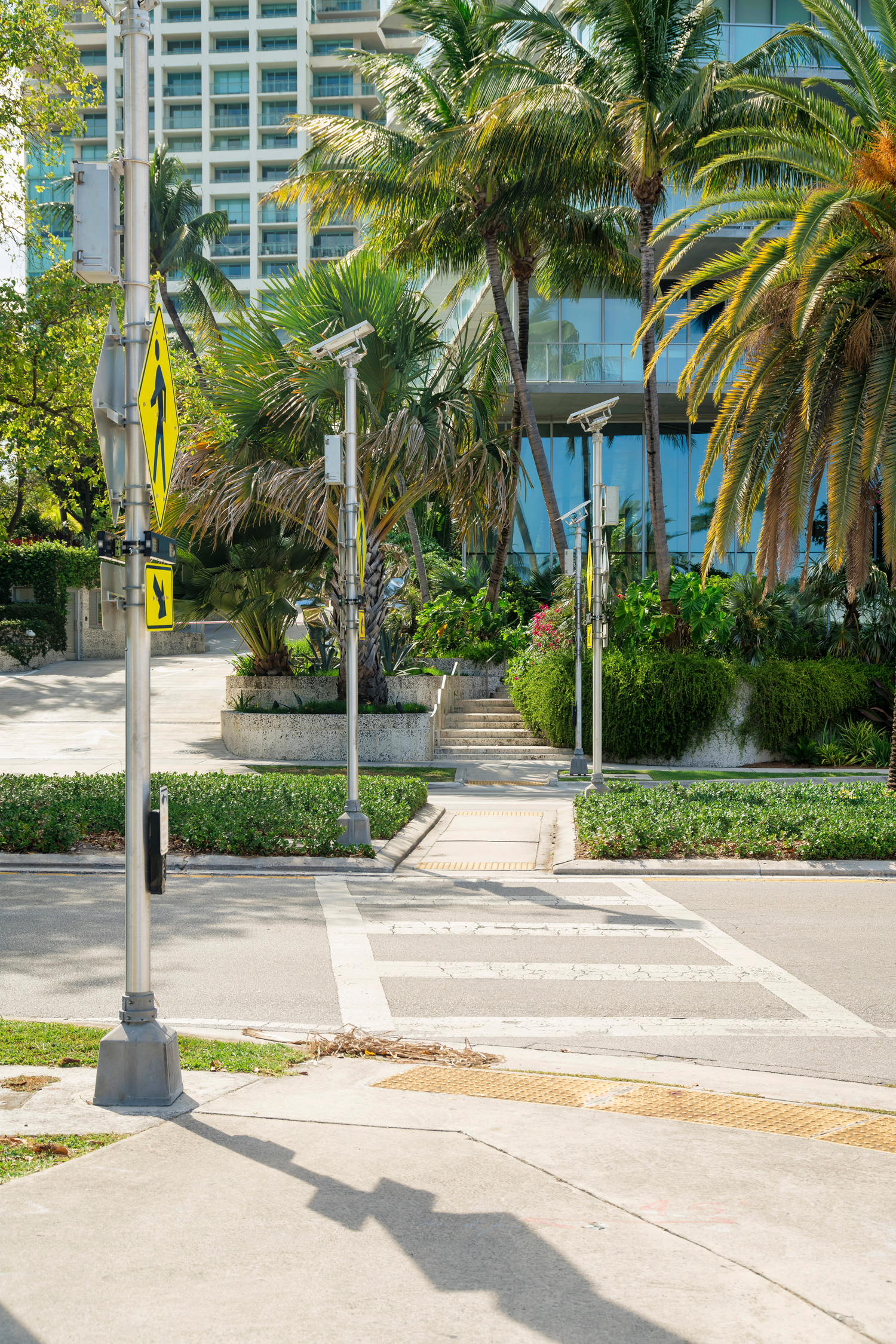
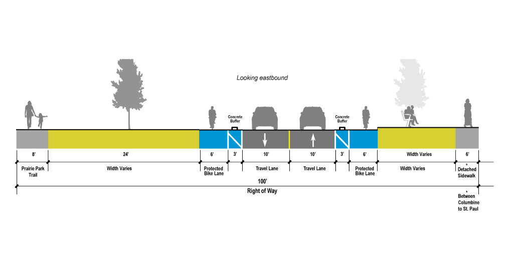
Improvements at major intersections are focused on making pedestrian and bicycle travel more safe, comfortable, and convenient while also exploring ways to make auto travel safer and more efficient.
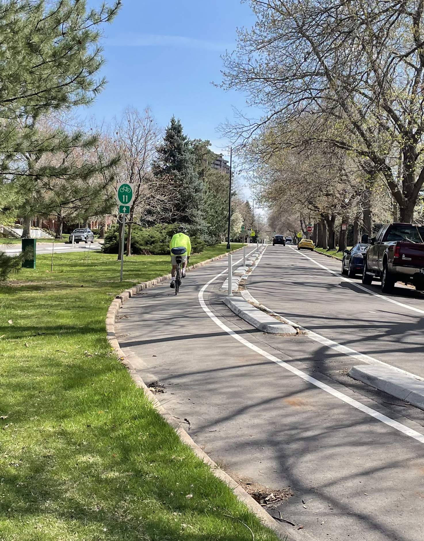
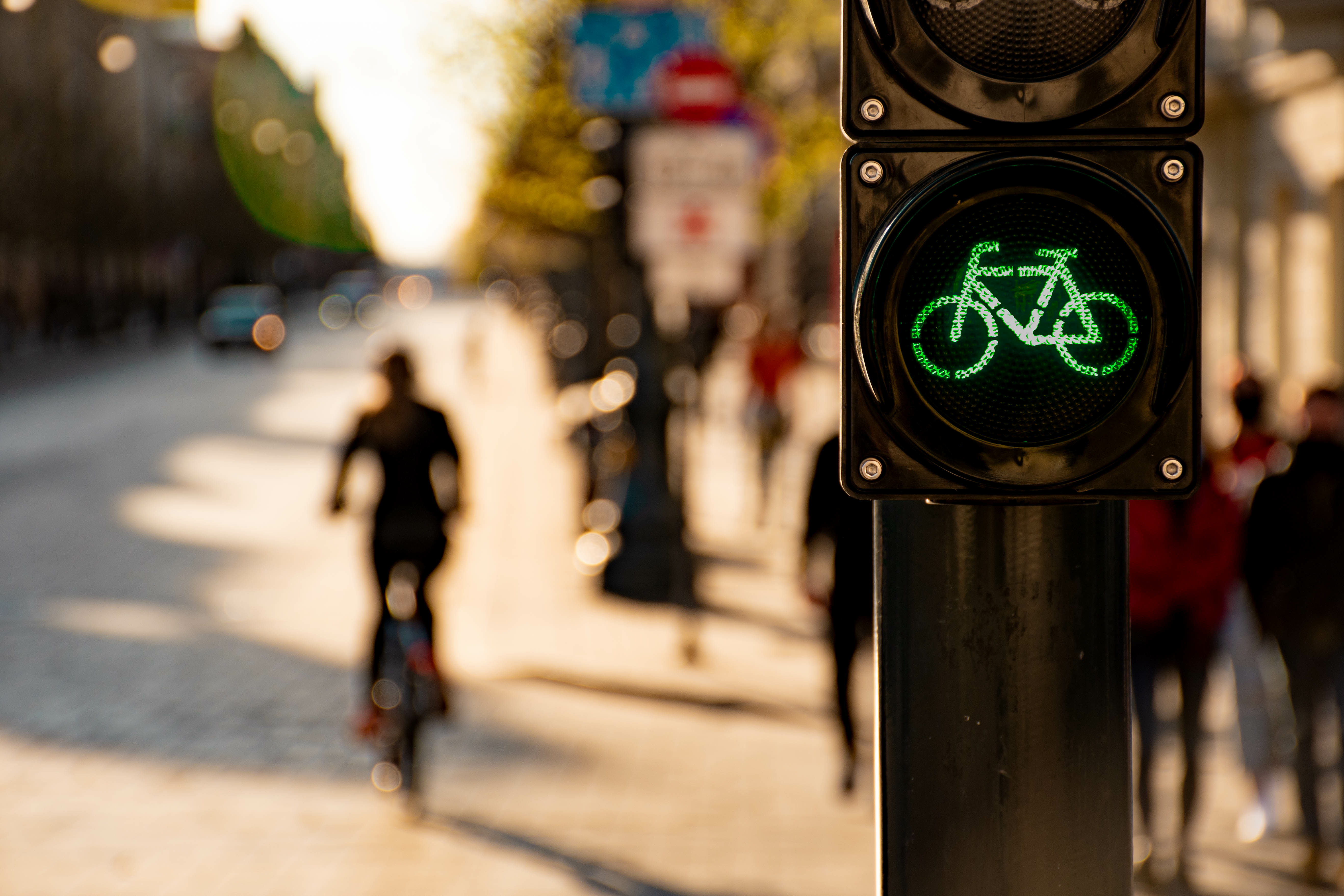
On a street like Buchtel, cyclists need protection from the higher volume and higher speed auto traffic. Concrete curbs will be installed as added protection in the buffer area between the bike lane and auto lane.
Updated traffic signing, way finding, and pavement markings throughout based on the Denver’s latest guidelines for pedestrian and bicycling facilities.
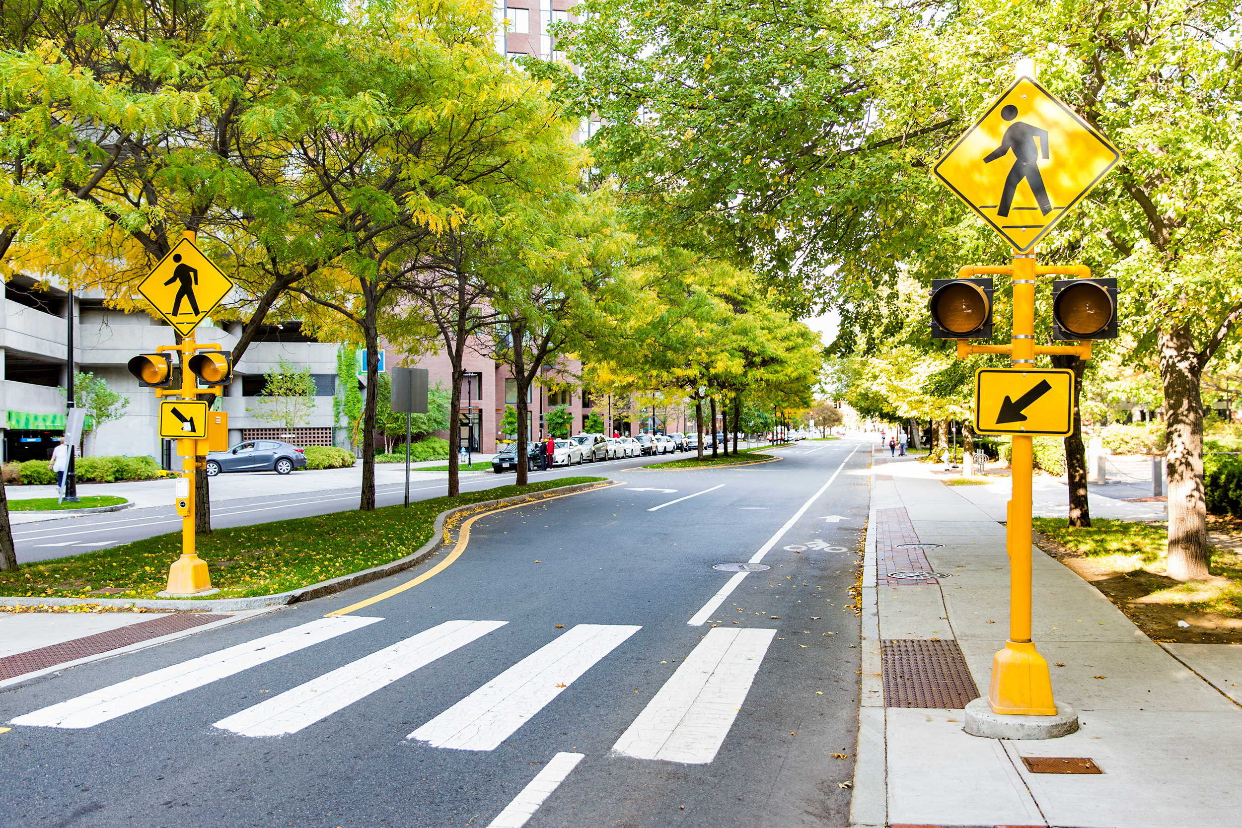
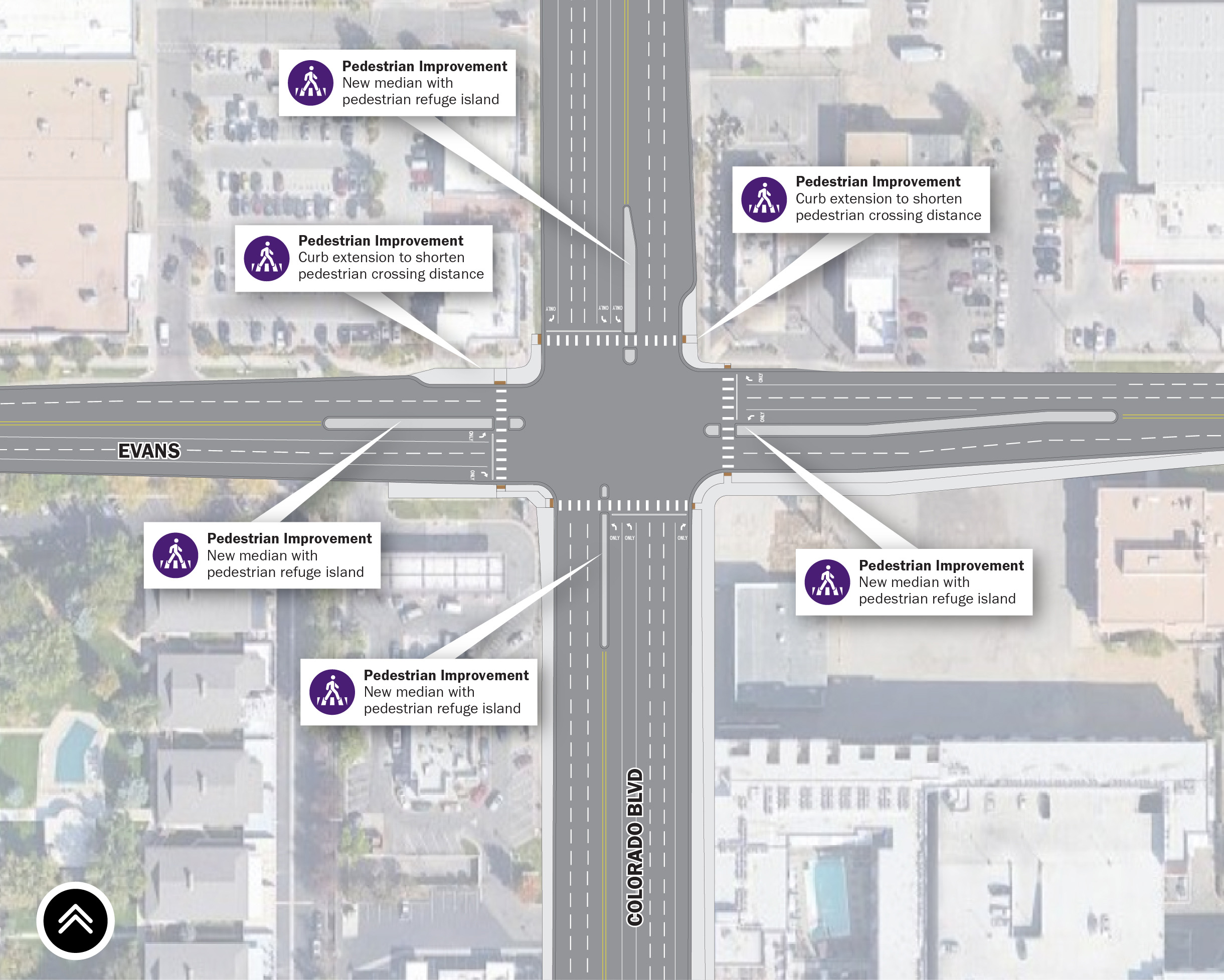
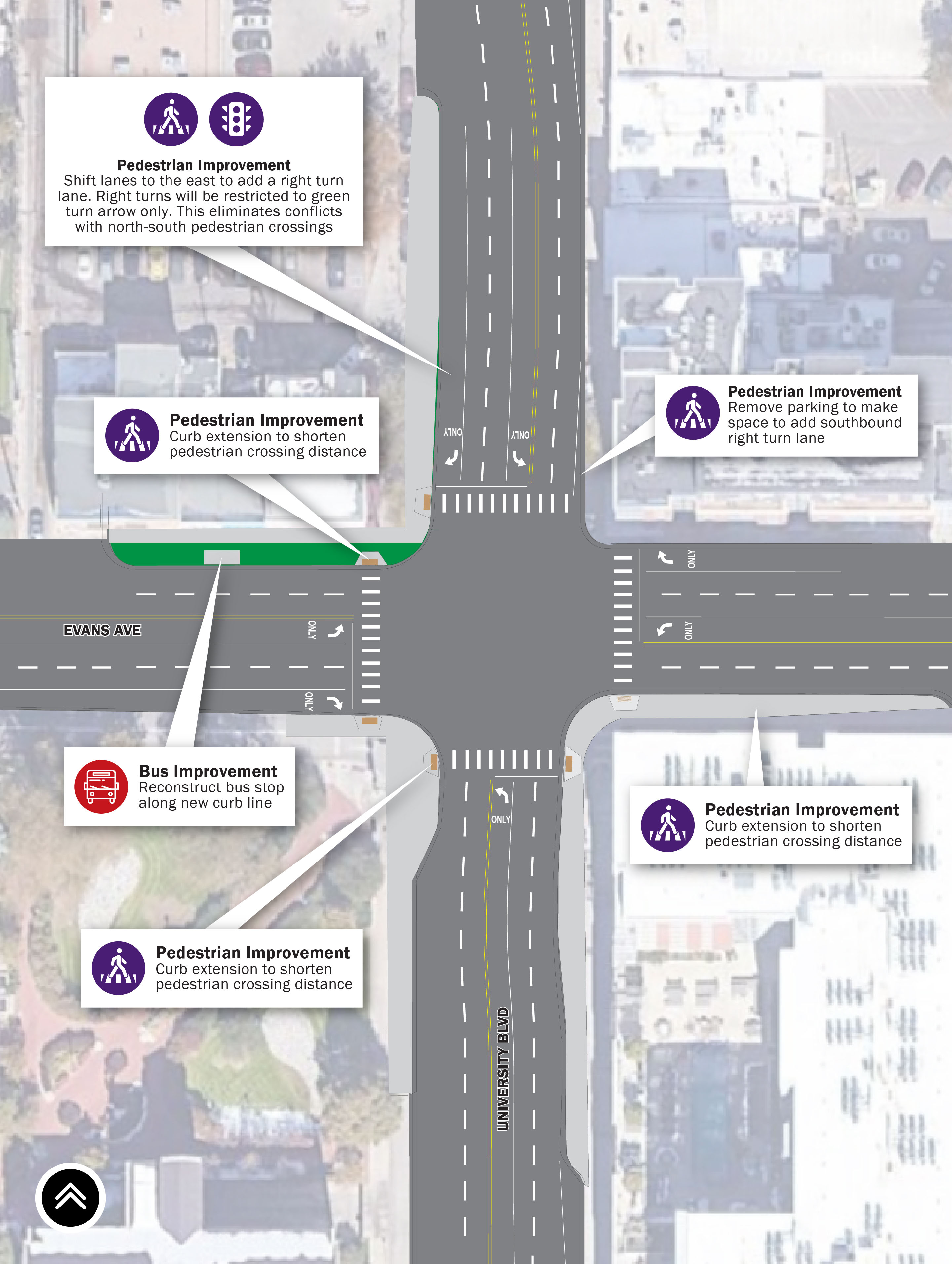
Crossing Buchtel can prove challenging with the higher levels of traffic and speeds. Providing safer crossings through the installation of crosswalks at Cook and Fillmore and Rectangular Rapid Flashing Beacons (RRFBs) will be used to supplement warning signs at mid-block crosswalks at Columbine and Monroe. The RRFBs alert motorists that pedestrians are using the crosswalk. Studies have shown that RRFBs significantly increase driver yielding behavior.
Pedestrian facilities will be improved along the corridor, including new detached sidewalks consistent with Denver's Complete Streets Guidelines. A proposed detached sidewalk will be installed between University Boulevard and St. Paul and a pedestrian refuge island will be installed at Colorado Boulevard and Evans Avenue.
Improvements are proposed at signalized intersections: Buchtel & University, Buchtel & St. Paul, and Buchtel & Colorado, Evans & University, and Evans & Colorado.
Click to enlarge
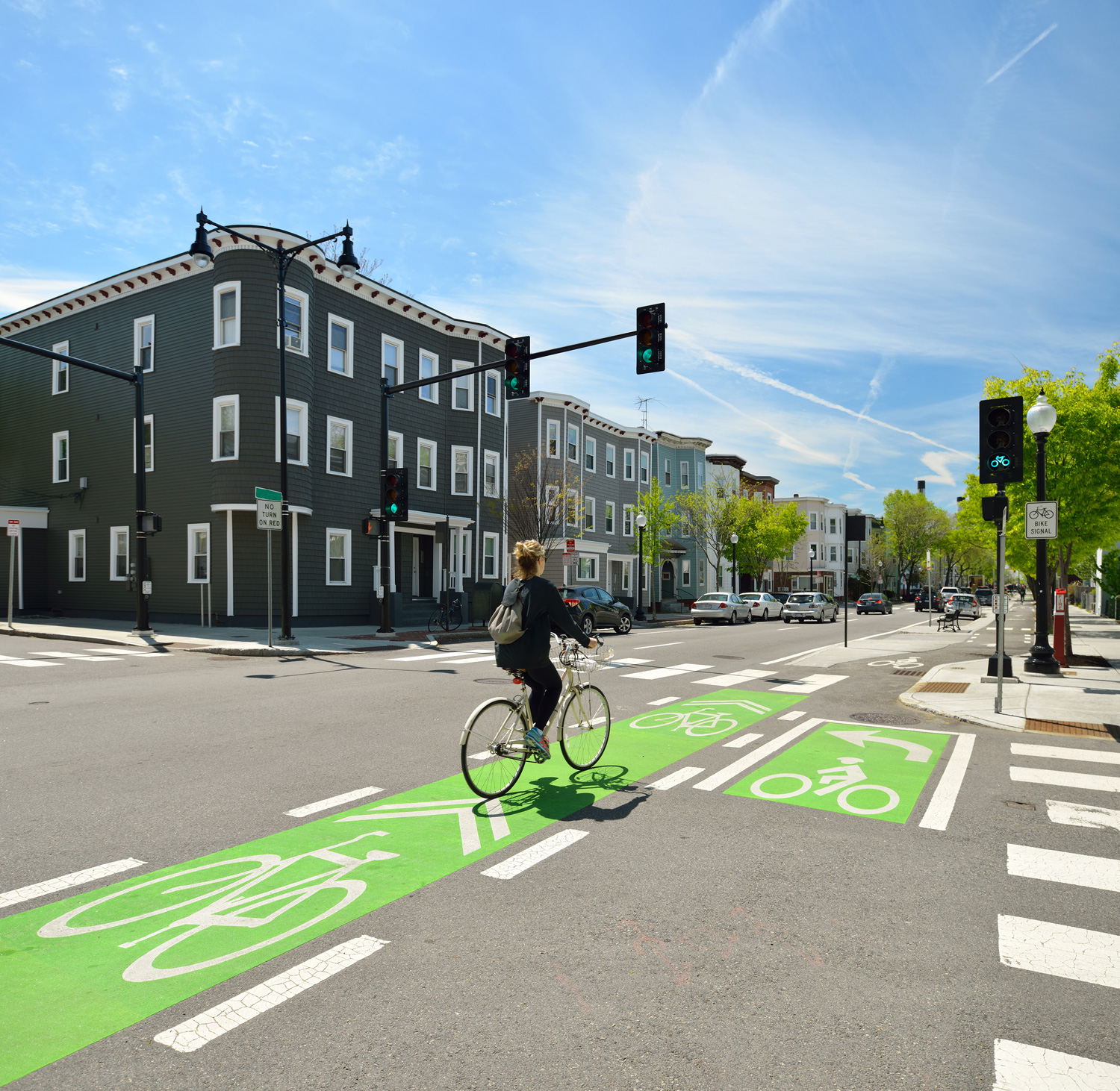
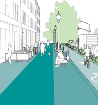
Complete Streets are streets for everyone. They are designed and operated to prioritize safety, comfort, and access to destinations for all people who use the street. Complete Streets make it easy to cross the street, walk to shops, jobs, and schools, bicycle to work, and move actively with assistive devices. They allow buses to run on time and make it safe for people to walk or move actively to and from train stations.
This makes the street network better and safer for people walking, biking, driving, riding transit, and moving actively — making your neighborhood connectivity a better place to live.
We’ve used community and stakeholder sentiment from 2017 to 2023 to identify bicycle facility improvements, safer intersections, safer crossing treatments, and improved signage, and lane markings for the Buchtel Complete Street and Evans Intersection Improvement project locations. The final design refinements you will be reviewing today have been drafted for the community to provide input to the final design.

Click on each tab below to view the design refinements and submit your thoughts.
Click map to enlarge
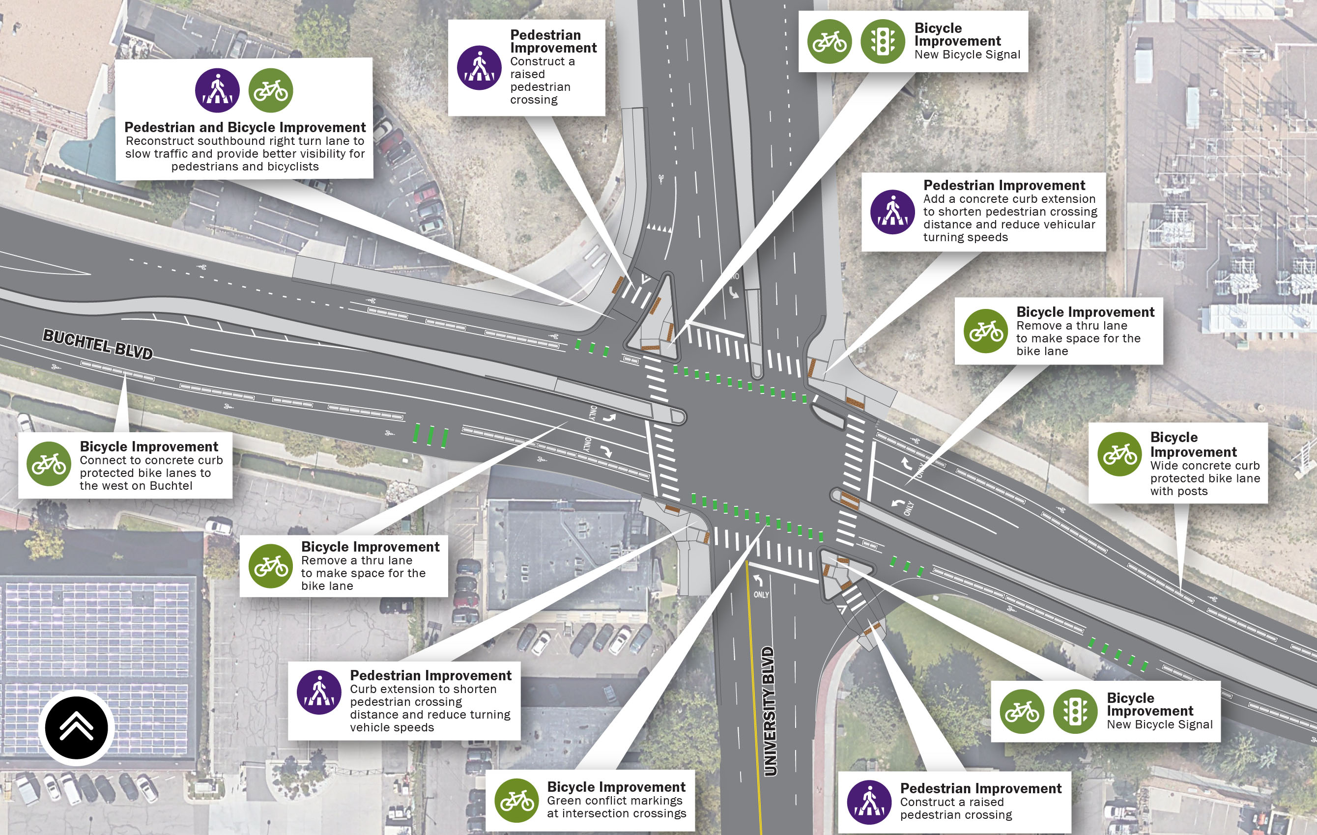
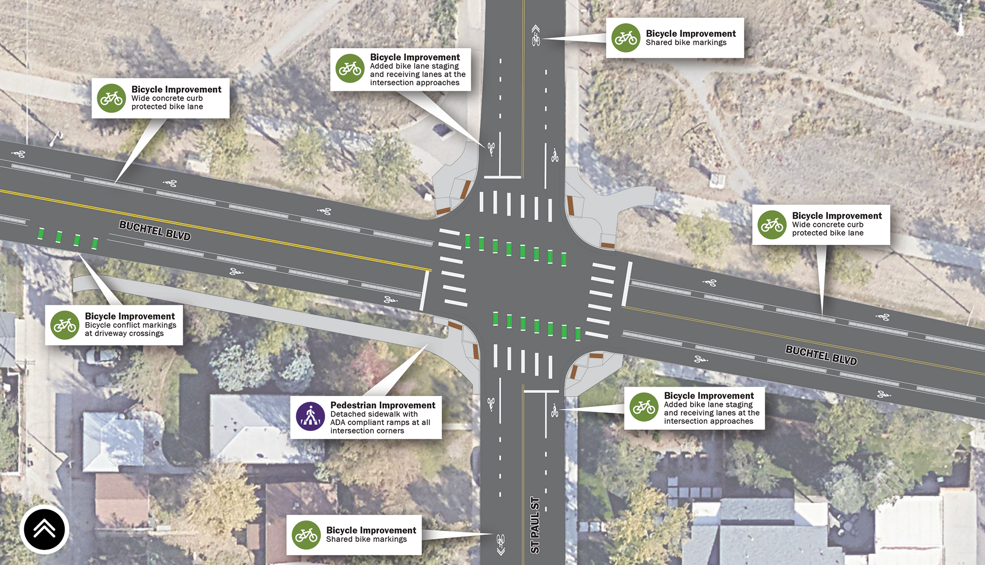
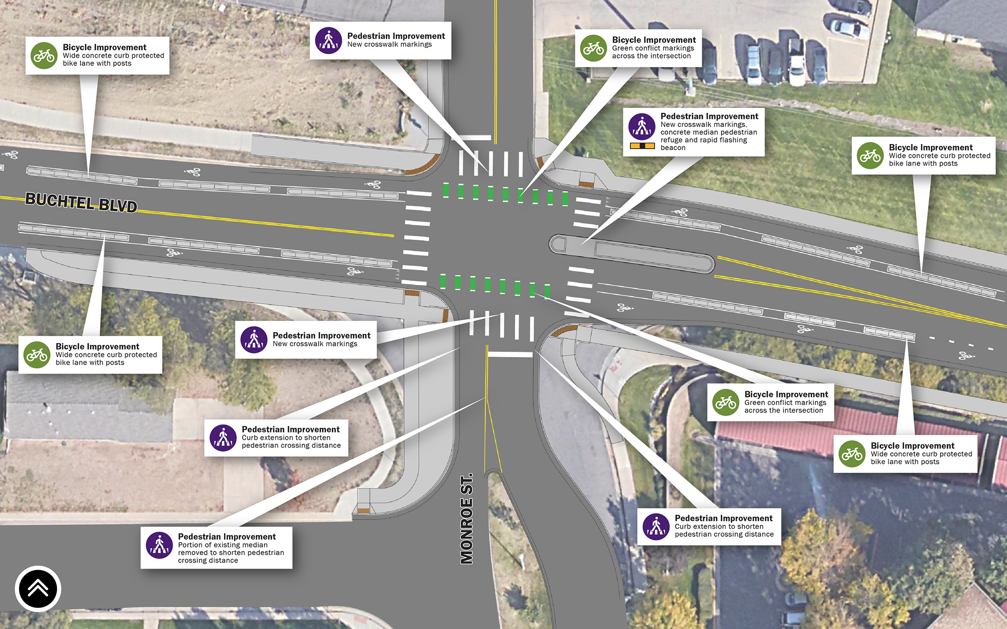
Changes coming to the intersection include:
Click map to enlarge
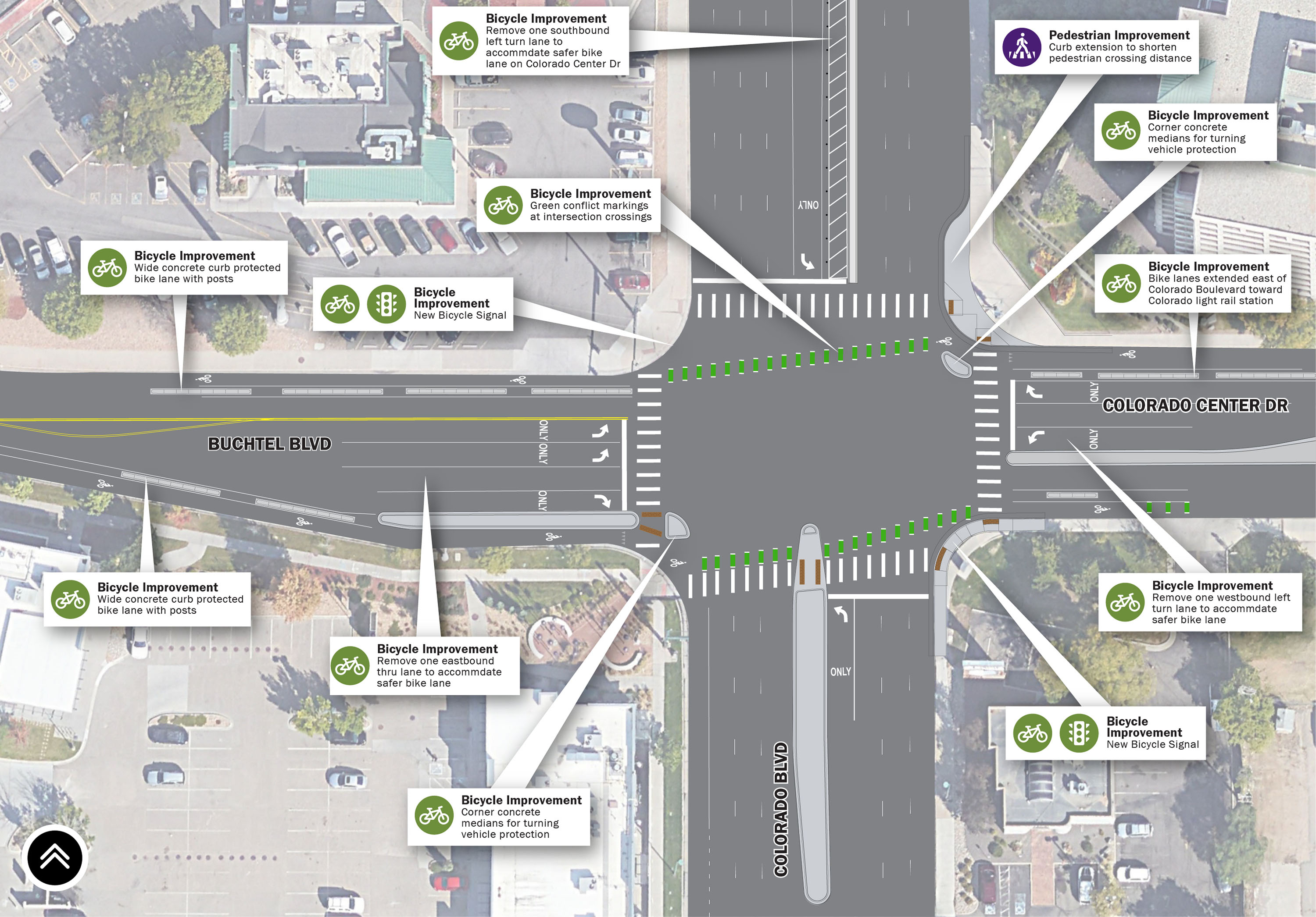
Changes coming to the intersection include:
Click map to enlarge
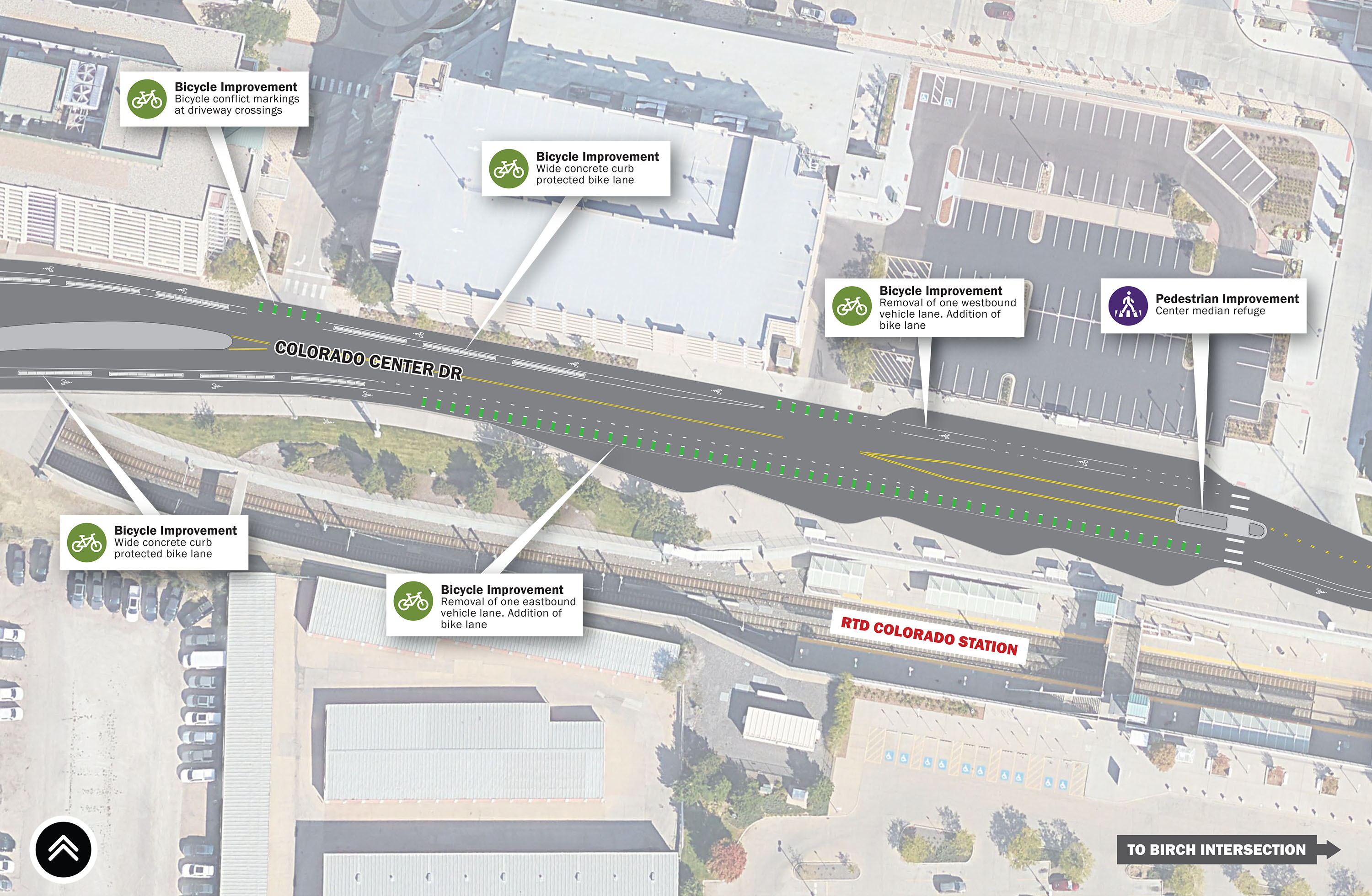
Changes coming to the intersection include:
Click map to enlarge
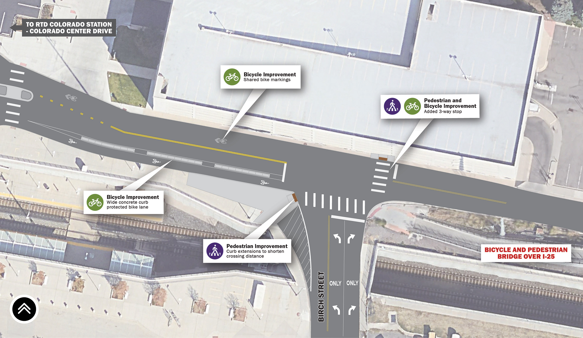
Changes coming to the intersection include:
Click map to enlarge
Changes coming to the intersection include:
Click map to enlarge
Changes coming to the intersection include:
Click map to enlarge
Changes coming to the intersection include:
Click map to enlarge
Changes coming to the intersection include:
Please let us know your thoughts on the design refinements.

As part of the NEPA process, the project team will be evaluating the following resources as part of the Programmatic Categorical Exclusion:
The National Environmental Policy Act (NEPA) requires federal agencies to assess the environmental effects of their proposed actions prior to making decisions.
A Categorical Exclusion (CE) is the most common NEPA class of action and are federal actions that do not individually or cumulatively have a significant environmental impact.
Click map to enlarge
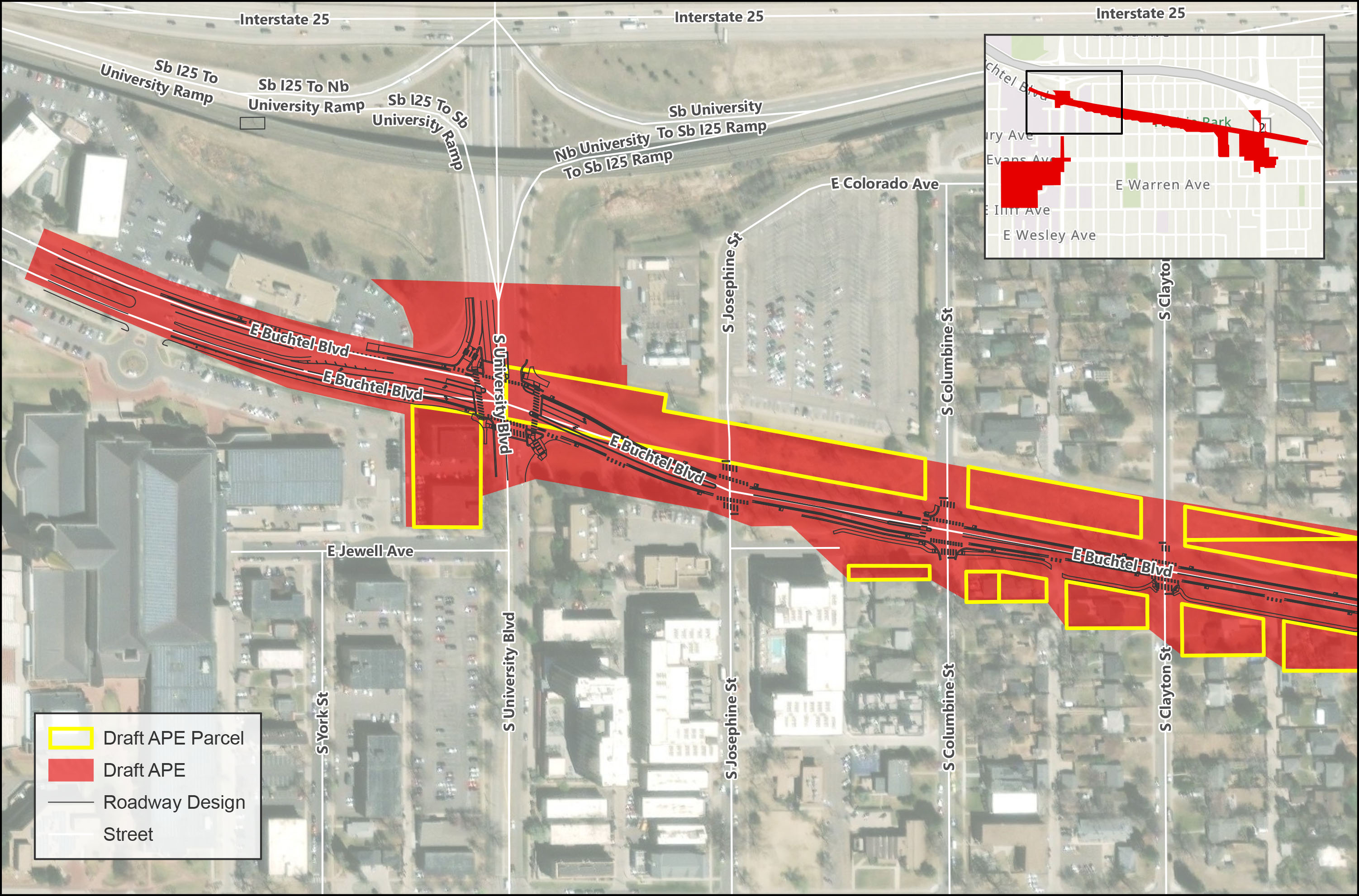
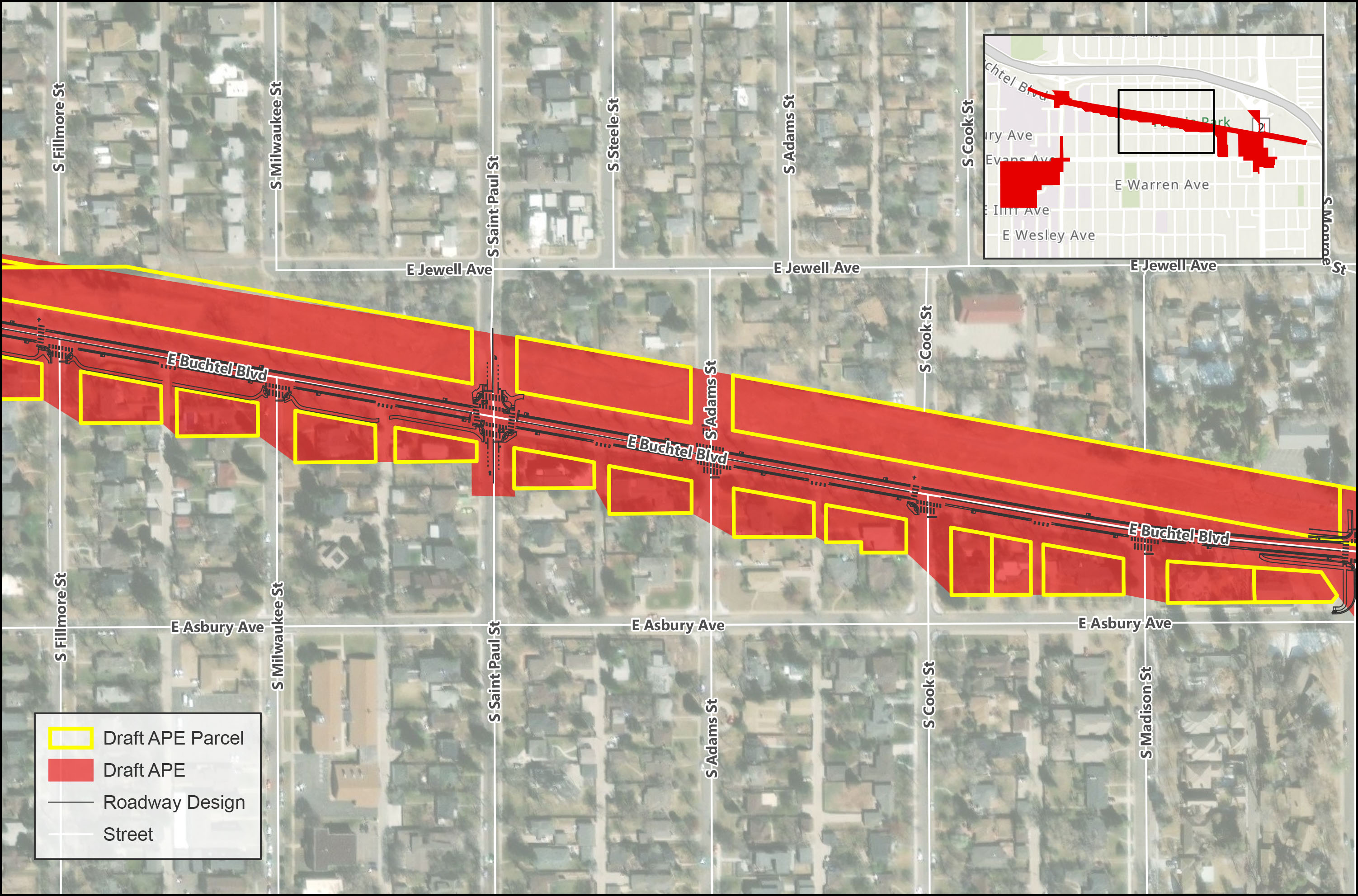
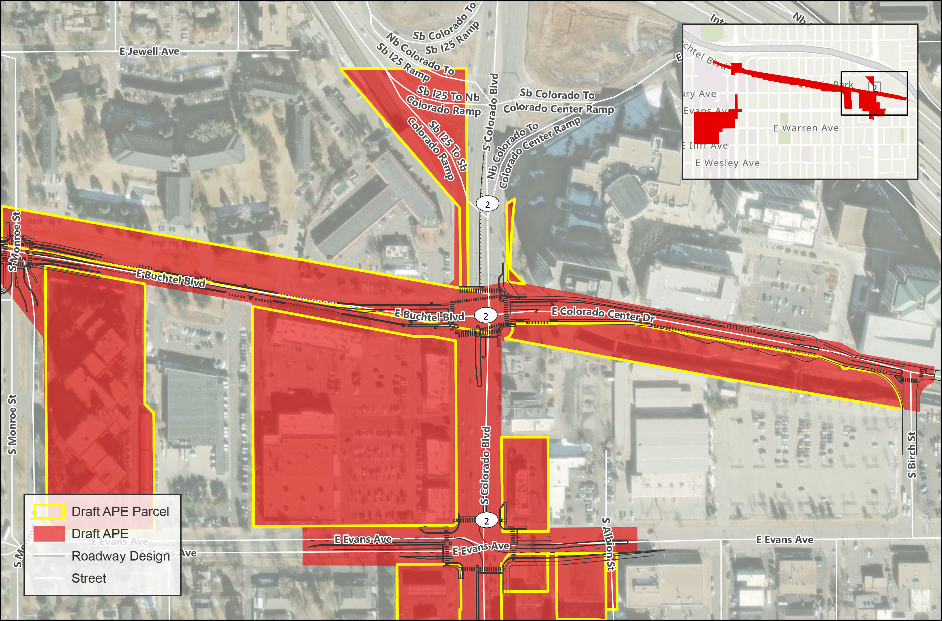
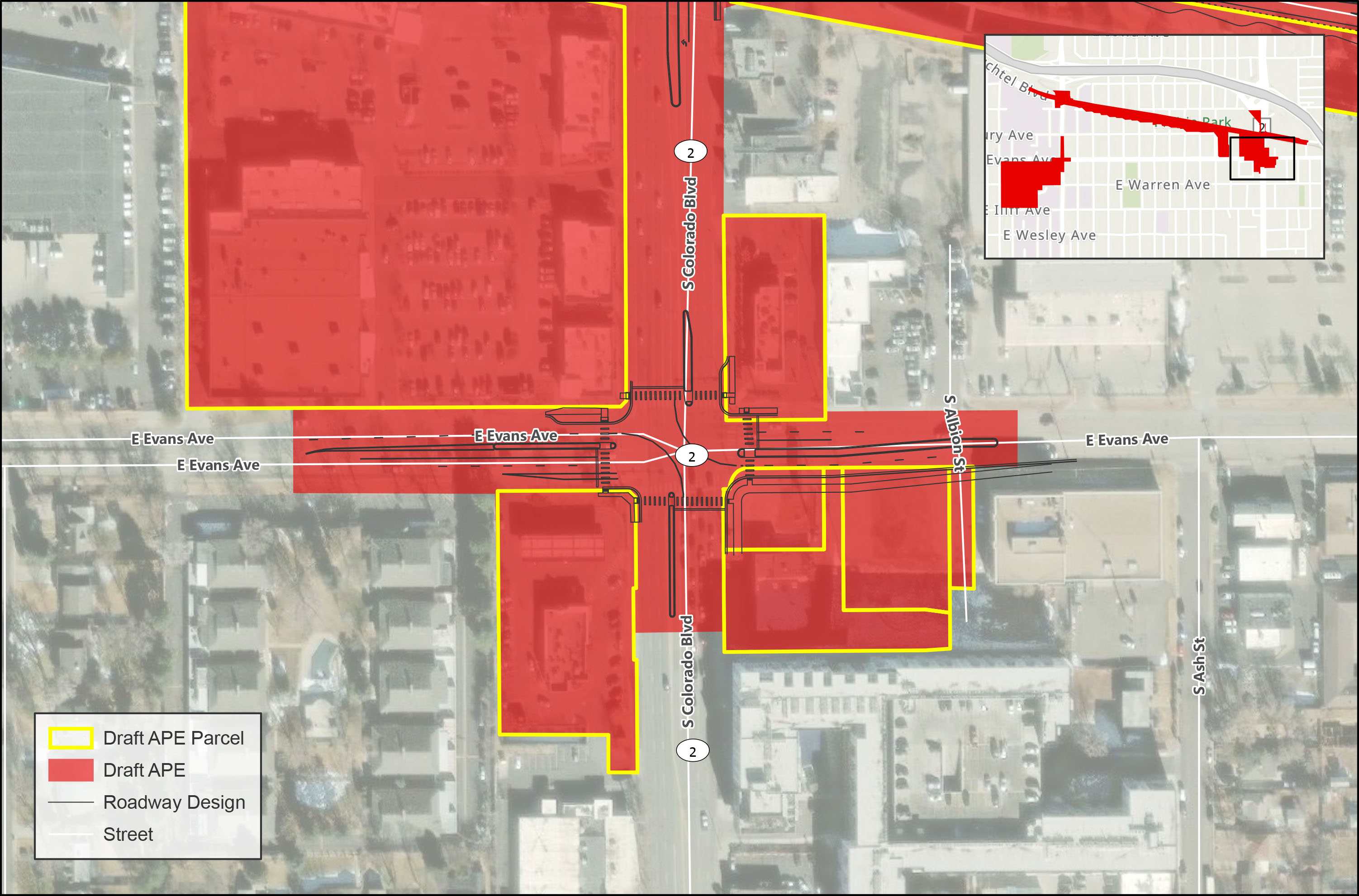
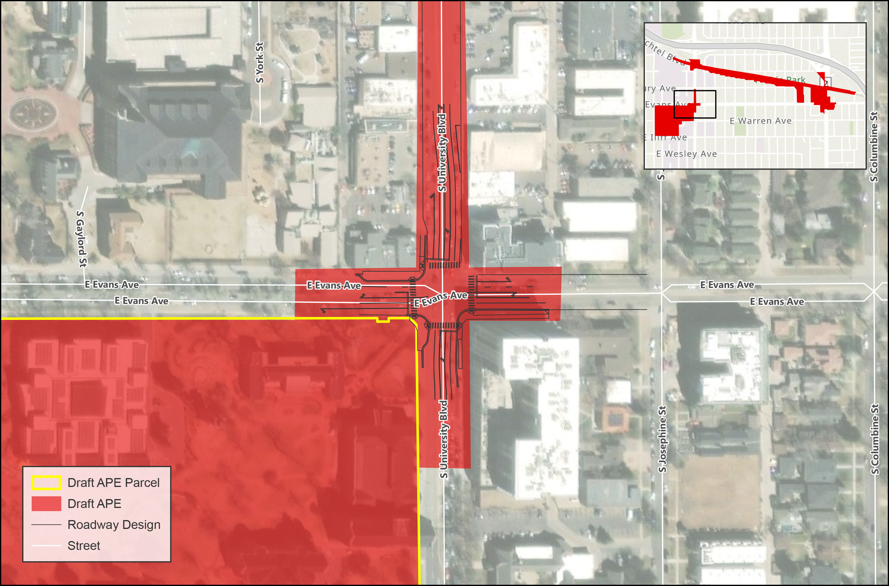
Section 106 of the National Historic Preservation Act of 1966 requires federal agencies to evaluate the effects of their undertakings on historic properties. The Project Team will complete Section 106 consultation for historic properties within the Area of Potential Effects (APE). The APE is the geographic area or areas within which an undertaking may directly or indirectly cause alterations in the character or use of historic properties.
The Project Team will be looking at the following recreational resources to evaluate impacts:
Recreational resource may be eligible for protection under Section 4(f).
Section 4(f) of the US DOT Act of 1966 declares that it is the policy of the United States Government that special effort should be made to preserve the natural beauty of the countryside and public park and recreation lands, and historic sites.

The City will be moving forward with this project over the next couple years in the following ways:
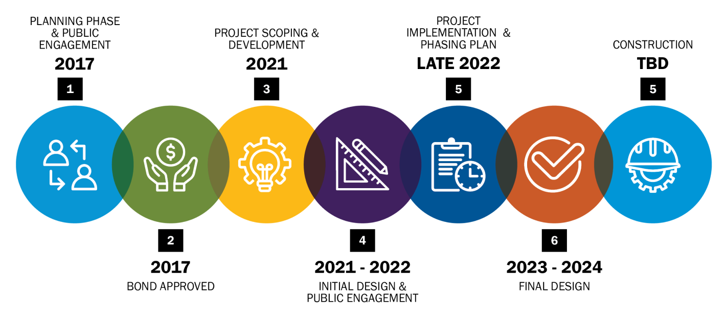
Click timeline to enlarge
Among other items, final design will address:
Stakeholder and public engagement will continue during this phase of the project.
The City and County of Denver will analyze the feedback collected from this online meeting to improve the final design refinements.


University Neighborhoods Safer Streets


Click the arrows on the bottom of your screen to go forward or backward.
Use the navigation bar on the left side of your screen to revisit any part of the online meeting.
Submit a comment by clicking the comment form in the upper right corner.